Showing posts with label forecast. Show all posts

Saturday, June 22, 2024

2024 Hurricanes - How They Work

2024 Hurricane Preparedness Week


Hurricane Basics & History

Hurricane Preparedness Week playlist on YouTube

"Too many families know the pain of having their lives and livelihoods devastated by powerful hurricanes, tropical storms, and typhoons. During National Hurricane Preparedness Week, we shed light on the dangerous impacts of hurricanes and share best practices on how to prepare and stay safe. We also show our gratitude to the first responders, volunteers, and all those who help to prepare communities in advance and rescue, recover, and rebuild in the wake of their darkest moments."  President Biden

Hurricane Zone
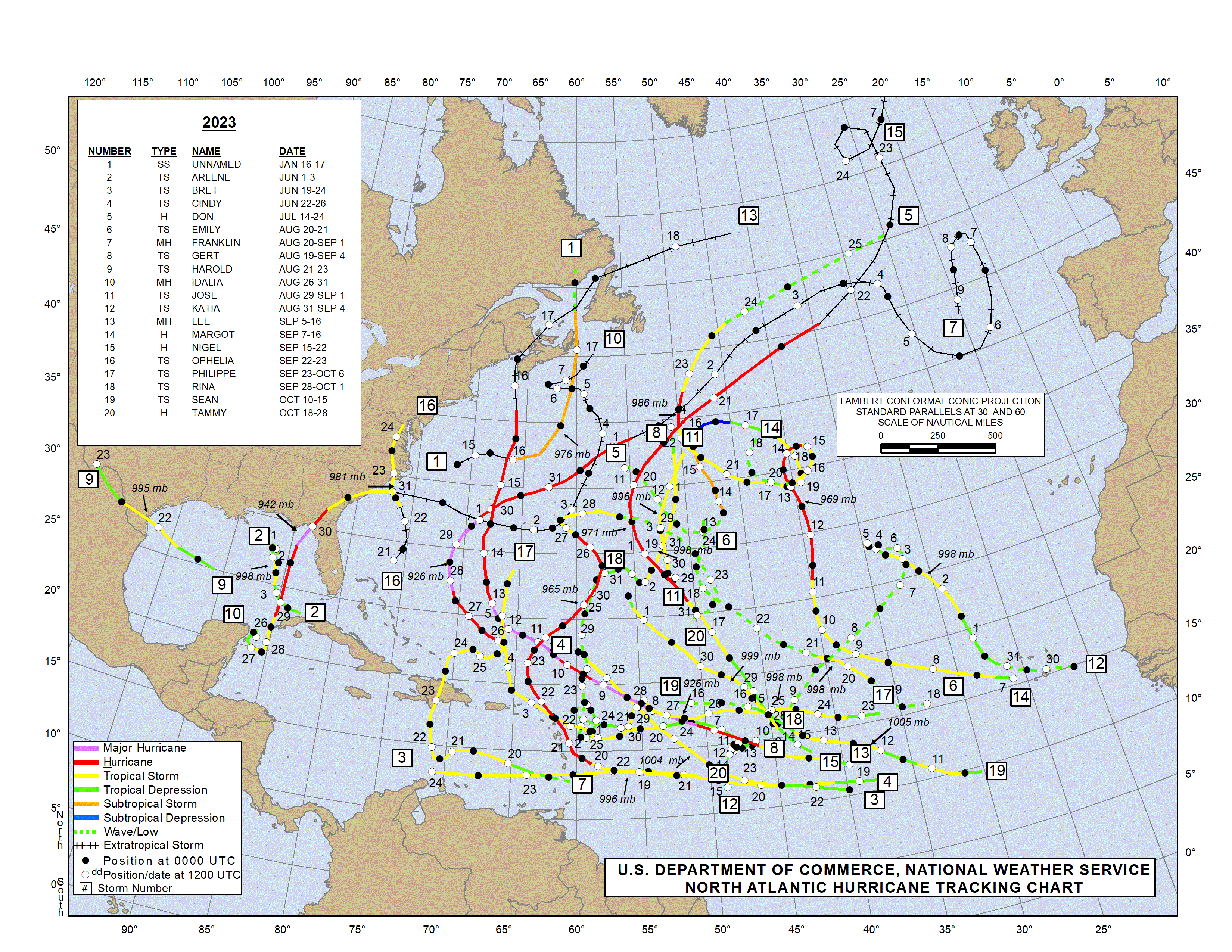
Looking for past or current hurricanes?  Click Image or Here

President Obama declared May 5 - May 11 “National Hurricane Preparedness Week." FEMA, along with the National Oceanic and Atmospheric Administration (NOAA), is helping to raise awareness of steps that can be taken to help protect citizens, and their communities and property. 

What is a Hurricane?
A hurricane is a type of tropical cyclone, which is a generic term for a low pressure system that generally forms in the tropics. The cyclone is accompanied by thunderstorms and, in the Northern Hemisphere, a counterclockwise circulation of winds near the earth's surface. Tropical cyclones are classified as follows:

* Sustained winds
A 1-minute average wind measured at about 33 ft (10 meters) above the surface.

** 1 knot = 1 nautical mile per hour or 1.15 statute miles per hour. Abbreviated as "kt".
Tropical Depression
An organized system of clouds and thunderstorms with a defined surface circulation and maximum sustained winds* of 38 mph (33 kt**) or less

Tropical Storm
An organized system of strong thunderstorms with a defined surface circulation and maximum sustained winds of 39-73 mph (34-63 kt)

Hurricane
An intense tropical weather system of strong thunderstorms with a well-defined surface circulation and maximum sustained winds of 74 mph (64 kt) or higher

Familiarize yourself with the terms that are used to identify a hurricane.
  • A hurricane watch means a hurricane is possible in your area. Be prepared to evacuate. Monitor local radio and television news outlets or listen to NOAA Weather Radio for the latest developments.
  • A hurricane warning is when a hurricane is expected in your area. If local authorities advise you to evacuate, leave immediately.
Hurricanes are classified into five categories based on their wind speed, central pressure, and damage potential. Category Three and higher hurricanes are considered major hurricanes, though Categories One and Two are still extremely dangerous and warrant your full attention.The following chart details the categories and the damage that can result from a storm with that strength.
 
Saffir-Simpson Hurricane Scale

Saffir-Simpson Hurricane Scale for Kids (NASA)

Scale Number (Category) Sustained  Winds Damage Storm Surge


1
74-95 mph
64-82 kt
119-153 km/h
Very dangerous winds will produce some damage: Well-constructed frame homes could have damage to roof, shingles, vinyl siding and gutters. Large branches of trees will snap and shallowly rooted trees may be toppled. Extensive damage to power lines and poles likely will result in power outages that could last a few to several days. 4-5 feet


2
96-110 mph
83-95 kt
154-177 km/h
Extremely dangerous winds will cause extensive damage: Well-constructed frame homes could sustain major roof and siding damage. Many shallowly rooted trees will be snapped or uprooted and block numerous roads. Near-total power loss is expected with outages that could last from several days to weeks. 6-8 feet


3 
(major)
111-129 mph
96-112 kt
178-208 km/h
Devastating damage will occur: Well-built framed homes may incur major damage or removal of roof decking and gable ends. Many trees will be snapped or uprooted, blocking numerous roads. Electricity and water will be unavailable for several days to weeks after the storm passes. 9-12 feet


4
(major)
130-156 mph
113-136 kt
209-251 km/h
Catastrophic damage will occur: Well-built framed homes can sustain severe damage with loss of most of the roof structure and/or some exterior walls. Most trees will be snapped or uprooted and power poles downed. Fallen trees and power poles will isolate residential areas. Power outages will last weeks to possibly months. Most of the area will be uninhabitable for weeks or months. 13-18 feet


5 
(major)
157 mph or higher
137 kt or higher
252 km/h or higher
Catastrophic damage will occur: A high percentage of framed homes will be destroyed, with total roof failure and wall collapse. Fallen trees and power poles will isolate residential areas. Power outages will last for weeks to possibly months. Most of the area will be uninhabitable for weeks or months. Greater than 18 feet

Hurricane History


In the following article, we  look at NOAA and Colorado State University forecasts for the 2024 Atlantic Hurricane Season which is expected to be very active.

NHC Data Archive

We will continue coverage of Hurricane Preparedness Week by looking at some of the hazards starting tomorrow.  Additional Hurricane information can be found in our static Hurricane Zone tab.


Hurricane Prep Series
Read entire series (click here)

More links and information about tropical storms and other weather conditions can be found in the Weather & Hurricane Zone tabs above.


If you live in, or plan to vacation in, an area where hurricanes are prevalent, please prepare in advance by reading our series.


I recently completed extensive training and have become Travel Safety Verified. As your dedicated Travel Advisor, your safety is our priority, and it's our job to ensure you have the necessary information you need to give you confidence and peace of mind when making your future travel plans. Click the link to review our Travel Safety program with valuable resources that will answer many of your questions.


Where have you explored? 

Gather your travel and food pics and join us every Wednesday for the latest installment of #FoodTravelChat


2024 CSU Atlantic Hurricane Prediction


2024 Atlantic Hurricane Forecast

Forecasters at the Colorado State University are predicting that the 2024 Atlantic basin hurricane season will have an extremely active 2024 hurricane season. The season begins June 1st and continues through November 30th.

UPDATED: JULY 9, 2024


On Tuesday, Colorado State researchers raised expectations following a hot start to the 2024 season. Experts are now expecting 25 named storms, 12 hurricanes and six major hurricanes in the Atlantic this year. The center pointed to Hurricane Beryl's record-breaking formation and intensity as indicative of the ongoing extreme conditions in the ocean.

 
Their current (June 11th) and past (April 4th) forecast predicts a 50% more likelyhood (over the averages from 1880 - 2020) for major hurricanes making landfall along the United States coastline and in the Caribbean.

The updated June forecast takes newly available data into consideration as the season commences. Uncertainty remains in the forecast, however, as the atmosphere-ocean system can sometimes change dramatically between this month and the peak of the Atlantic hurricane season, which runs from August–October.

As is customary, NOAA made their first prediction at the end of May. So, why does Colorado State University's team of scientists create an April forecast? Mainly because the public is curious about predictions based on the current global oceanic and atmospheric conditions. The forecasting team created their predictions using a statistical model based on 29 years worth of data.  This is the 41st year in which the CSU Tropical Meteorology Project has made forecasts of the upcoming season’s Atlantic basin hurricane activity.

Not the storm you are looking for?  Click Image or Here

According to CSU scientists, "El Niño conditions are weakening quickly across the tropical Pacific and are likely to transition to La Niña conditions by the peak of the Atlantic hurricane season. La Niña tends to weaken upper-level westerly winds across the Caribbean and the tropical Atlantic. These decreased upper-level winds result in reduced vertical wind shear, favoring Atlantic hurricane formation and intensification. "

Coastal residents are reminded that it only takes one hurricane making landfall to make it an active season for them, and they need to prepare the same for every season, regardless of how much or how little activity is predicted.

The Juine forecast calls for 23 named tropical storms with 11 strengthening to hurricane status. Of those hurricanes, 5 are predicted to be a major hurricane (Category 3,4, or 5). The team will issue additional forecasts on July 9 and Aug. 6.

The report also includes the probability of major hurricanes making landfall:
 
The team forecasts 62% for the entire U.S. coastline (average from 1880–2020 is 43%),34% for the U.S. East Coast, including the Florida peninsula (average from 1880–2020 is 21%),42% for the Gulf Coast from the Florida panhandle westward to Brownsville (average from 1880–2020 is 27%), and 66% for the Caribbean (average from 1880–2020 is 47%).

This is the highest predicted number of hurricanes that CSU has ever issued in a June outlook. The prior high was for 10 hurricanes in 2010 (when 12 were observed) and in 2022 (when eight were observed). June forecasts have been issued by CSU since 1984.
 
More reading: Current and Past Forecasts


Another reason why Colorado State University publishes forecasts is for hurricane preparedness.   We too are publishing this information, along with updates throughout hurricane season, to help protect life and property when danger approaches.

As I've said many times,  the cruise line industry has safety of passengers, crew, and vessels as their number one priority.   The cruise lines work closely with the NHC and other agencies to monitor all sorts of weather conditions, including tropical storms.   The ships may alter courses and cancel ports of call in order to maintain the level of safety for all onboard.  We will keep you posted about any known itinerary changes during hurricane season.   Should your cruise itinerary change due to a tropical storm, don't be upset, but rather thank the Captain and crew for taking you out of harm's way.  Read our blog post 4 Things To Help Plan Vacation in Hurricane Season...

More links and information about tropical storms and other weather conditions can be found in the Weather & Hurricane Zone tabs above.  We will feature several articles during Hurricane Preparedness week once again.   Until then, you can click the link below for last year's series.

Read Entire Series (click here)


I recently completed extensive training and have become Travel Safety Verified. As your dedicated Travel Advisor, your safety is our priority, and it's our job to ensure you have the necessary information you need to give you confidence and peace of mind when making your future travel plans. Click the link to review our Travel Safety program with valuable resources that will answer many of your questions.


Where have you explored? 

Gather your travel and food pics and join us every Wednesday for the latest installment of #FoodTravelChat


Thursday, January 9, 2020

2019 in Review

As the year drew to a close, we took a look at some of the industry headlines and reviewed some of our cruise adventures.  Weather made the biggest headlines impacting the cruise industry in 2019.  The cruise industry responded to the hurricane devastation with outpouring of support and supplies.

Cruising continues to increase in popularity as more than 30 million guests took to the seas on a cruise vacation in 2019, according to Cruise Line Industry Association (CLIA) State of the Cruise Industry Report.  "While demand for cruising has reached new heights, the cruise industry is accelerating our efforts to be a leader in responsible tourism." said Kelly Craighead, CLIA President and CEO.

The cruise lines continued to add capacity,  introducing 18 new ships bringing the total to 272 CLIA-member cruise ships.


Viking Jupiter Photo Album
 "First New Cruise Ship
for 2019"


Once again honors went to Viking Ocean Cruises as it took delivery of the fourth ship in Viking Ocean's fleet, Viking Jupiter, in February. It is virtually identical to sister ships Viking Sea, Viking Sky , Viking Star  and Viking Sun, featuring 930-passenger capacity with highlights such as the Explorer Lounge, a two-deck observation library with lots of comfy chairs and couches; the Nordic-inspired spa with Finnish sauna and snow room; the indoor/outdoor Aquavit Terrace dining venue; and a magrodome pool, with a glass roof that opens in warm weather.

Viking Ocean ships are all-balcony cruise ships with the smallest cabins measuring a sizable 270 square feet; the largest suites comes in at 1,300 square feet. The ships specialize in destination-oriented cruise experiences with long days in ports, plenty of overnights in major cities and few days at sea.

Cruise fares include a selection of free shore excursions, complimentary Wi-Fi, and beer and wine at lunch and dinner offering good value for the cruise price.


Love that New Ship Smell

Our 2019 National Conference took place on Royal Caribbean Symphony of the Seas. We had our pre-cruise reception, hosted by   MSC Cruises,  at Hyatt Regency Miami.  MSC celebrated the launch of it's new private island in the Bahamas, Ocean Cay (watch video).

Symphony of the Seas is an Oasis-class cruise ship owned and operated by Royal Caribbean International. She is the largest passenger ship in the world by gross tonnage, at 228,021 GT, surpassing her sister Harmony of the Seas. Having our conferences on a relatively new ship, was one of our highlights for the year.

If you have specific questions about the ships, the itineraries, or cruising in general, we'd love to hear from you.
 
Weather Impact on Cruises


The damaging slow-moving storms of 2019 were Hurricane Barry (Louisiana, $600 million in damage), Hurricane Dorian (The Bahamas, Southeast U.S. and Canada, at least $4.6 billion in damage), Tropical Storm Imelda (Texas and Louisiana, $2 billion in damage), and Tropical Storm Fernand (northeast Mexico, $250 million in damage). 


Throughout September and October, we were posting itinerary updates as schedules were impacted by either the approaching storms or following the landfall.

Cruise lines rushed to aid victims with several voyages cancelled to launch rescue and supply missions.  The industry response was like no other in history.   We are proud to be part of this industry as everyone joined together to help in this time of need. 

At our conference, industry leaders from the cruise lines and organizations stressed that while there had been a tremendous response to date, it was crucial that we as Travel Professionals helped get the message out that the Bahamas & Caribbean is Open for Business.   They still need our help to recover from the hurricanes.   One of the ways this can be done is by bringing tourism dollars back into the regions hit hardest by the hurricanes.

Our Favorite Cruises for 2019

Having cruised for 30+ years, our cruise selections are driven primarily by destination and secondly by cruise ship. We love exploring new destinations from our bucket list as well as revisiting some of our favorites. Exploring new ships, including older ships we've never sailed on before, is also quite enjoyable. Of course, we love to share with our readers so that they can discover the world that awaits them.  In addition to our conference cruise on Symphony of the Seas, here were our other journeys.


13 Day Syndney Australia to New Zealand Cruise

Click on the image to the left for  Blog posts about this trip.

During our Southeast Asia Voyage we took advantage of the book onboard and anniversary sale to plan our next cruise.   New Zealand was identified as a popular destination for 2019, so in order to bring our clients first-hand experiences of this destination and the latest ship from Princess Cruises, Majestic Princess, this was the cruise we selected.   Follow along on our journey to the land down under.

Photos can be found on our Australia & New Zealand Shutterfly page


Magic Carpet

There's no shortage of innovation on Celebrity Edge. The industry-first Magic CarpetSM is both the best way to take in spectacular views and the most exciting place to be. By changing function and location, it provides an incredible array of visual perspectives and a distinct experience on every deck it visits. We particularly enjoyed having a drink while enjoying a sunset during our past cruise. 

This is only the beginning of what awaits you on Celebrity Edge. We posted on our social media accounts throughout the cruise and have begun our diary (click image).   Bookmark the page to learn more about our trip.


What's Ahead for 2020

As this is an election year in the U.S., there's a lot of uncertainty as the new year and new decade begins.   At our national conference, cruise lines execs told us that they are planning for any impact from election year by having their best deals early to fill the ships in advance of the elections.  They all told us that bookings are strong and this should be another good year for the industry.

It will be a rebuilding year for the Caribbean and Bahamas and another ship building year as well.  What will the added capacity mean?   There are still a large percentage of the population that have not experienced cruising.   The lines, including new players like Dream Cruises and Virgin Voyages, will continue to advertise which will help spread the word.

As cruise prices stabilized, many lines have been looking to onboard expenditures as a means to increase revenue.   Items that had once been included, like room service, have started to see additional charges for example.   Some passengers aren't happy with the new trend to "nickle-and-dime" them and may look to cruise lines that have less optional charges.   Luxury lines are becoming an even better value since you know your cost of the entire trip up front.

It will be interesting to see how new players, such as Viking Oceans, impacts the industry as they grow their fleets.  They are bucking the tide to go big and instead opting for smaller ships and more emphasis on the destinations.  Of course, the river cruise industry is booming as the demand soars for this method of exploring the globe. Crystal has entered the market as well, bringing another luxury option to this growing market.

Travel Professionals are not going away.  In fact, their expertise is even more valuable now, as there are more and more options to sort through.   Matching the right ship and itinerary to the cruisers' desires is one of the biggest values they bring to bear.   Hope to see you on the seven seas in 2020.

Happy New Year


@ChrisPappinMCC


Connect With Us On


Sign-up for Exclusive Email Offers


Where have you explored? 

Gather your travel and food pics and join us every Wednesday night for the latest installment of #FoodTravelChat