Showing posts with label predictions. Show all posts

Saturday, June 22, 2024

2024 CSU Atlantic Hurricane Prediction


2024 Atlantic Hurricane Forecast

Forecasters at the Colorado State University are predicting that the 2024 Atlantic basin hurricane season will have an extremely active 2024 hurricane season. The season begins June 1st and continues through November 30th.

UPDATED: JULY 9, 2024


On Tuesday, Colorado State researchers raised expectations following a hot start to the 2024 season. Experts are now expecting 25 named storms, 12 hurricanes and six major hurricanes in the Atlantic this year. The center pointed to Hurricane Beryl's record-breaking formation and intensity as indicative of the ongoing extreme conditions in the ocean.

 
Their current (June 11th) and past (April 4th) forecast predicts a 50% more likelyhood (over the averages from 1880 - 2020) for major hurricanes making landfall along the United States coastline and in the Caribbean.

The updated June forecast takes newly available data into consideration as the season commences. Uncertainty remains in the forecast, however, as the atmosphere-ocean system can sometimes change dramatically between this month and the peak of the Atlantic hurricane season, which runs from August–October.

As is customary, NOAA made their first prediction at the end of May. So, why does Colorado State University's team of scientists create an April forecast? Mainly because the public is curious about predictions based on the current global oceanic and atmospheric conditions. The forecasting team created their predictions using a statistical model based on 29 years worth of data.  This is the 41st year in which the CSU Tropical Meteorology Project has made forecasts of the upcoming season’s Atlantic basin hurricane activity.

Not the storm you are looking for?  Click Image or Here

According to CSU scientists, "El Niño conditions are weakening quickly across the tropical Pacific and are likely to transition to La Niña conditions by the peak of the Atlantic hurricane season. La Niña tends to weaken upper-level westerly winds across the Caribbean and the tropical Atlantic. These decreased upper-level winds result in reduced vertical wind shear, favoring Atlantic hurricane formation and intensification. "

Coastal residents are reminded that it only takes one hurricane making landfall to make it an active season for them, and they need to prepare the same for every season, regardless of how much or how little activity is predicted.

The Juine forecast calls for 23 named tropical storms with 11 strengthening to hurricane status. Of those hurricanes, 5 are predicted to be a major hurricane (Category 3,4, or 5). The team will issue additional forecasts on July 9 and Aug. 6.

The report also includes the probability of major hurricanes making landfall:
 
The team forecasts 62% for the entire U.S. coastline (average from 1880–2020 is 43%),34% for the U.S. East Coast, including the Florida peninsula (average from 1880–2020 is 21%),42% for the Gulf Coast from the Florida panhandle westward to Brownsville (average from 1880–2020 is 27%), and 66% for the Caribbean (average from 1880–2020 is 47%).

This is the highest predicted number of hurricanes that CSU has ever issued in a June outlook. The prior high was for 10 hurricanes in 2010 (when 12 were observed) and in 2022 (when eight were observed). June forecasts have been issued by CSU since 1984.
 
More reading: Current and Past Forecasts


Another reason why Colorado State University publishes forecasts is for hurricane preparedness.   We too are publishing this information, along with updates throughout hurricane season, to help protect life and property when danger approaches.

As I've said many times,  the cruise line industry has safety of passengers, crew, and vessels as their number one priority.   The cruise lines work closely with the NHC and other agencies to monitor all sorts of weather conditions, including tropical storms.   The ships may alter courses and cancel ports of call in order to maintain the level of safety for all onboard.  We will keep you posted about any known itinerary changes during hurricane season.   Should your cruise itinerary change due to a tropical storm, don't be upset, but rather thank the Captain and crew for taking you out of harm's way.  Read our blog post 4 Things To Help Plan Vacation in Hurricane Season...

More links and information about tropical storms and other weather conditions can be found in the Weather & Hurricane Zone tabs above.  We will feature several articles during Hurricane Preparedness week once again.   Until then, you can click the link below for last year's series.

Read Entire Series (click here)


I recently completed extensive training and have become Travel Safety Verified. As your dedicated Travel Advisor, your safety is our priority, and it's our job to ensure you have the necessary information you need to give you confidence and peace of mind when making your future travel plans. Click the link to review our Travel Safety program with valuable resources that will answer many of your questions.


Where have you explored? 

Gather your travel and food pics and join us every Wednesday for the latest installment of #FoodTravelChat


Friday, August 16, 2013

Hurricane Predictions for Remainder of 2013 Atlantic Season


What's the Remainder of 2013 Atlantic 
Hurricane Season Look Like?


Forecast of Atlantic Seasonal Hurricane Activity and Landfall Strike Probability for 2013 (PDF)

The tropical Meteorology Project at Colorado State University looks at the Atlantic Hurricane Season forecast several times a year.   The initial forecast is released in early April with the second report being released at the start of the season in June.

We are now entering what typically is the start of the active part of the season with storms forming in the vicinity of Cape Verde Islands.   The chart above reflects the storms to date along with the revised forecast.

COLORADO STATE UNIVERSITY FORECAST OF ATLANTIC HURRICANE 


According to the report:  

"We continue to anticipate an above-average season in 2013, although we have lowered our forecast slightly due to anomalous cooling in the eastern subtropical and tropical Atlantic. We expect an above-average probability of United States and Caribbean major hurricane landfall"


Not "Out of the Woods"

At first read, you might think we have nothing to worry about.  Well, if you review the chart closely, you'll notice there have not been any major hurricanes in the Atlantic so far this year, however, there are at least 3 still predicted.   That means, there's a lot of potential for a powerful storm.

Read the entire article (PDF link above) to get complete details about their forecast, including background information about how they come to these conclusions.

NOAA Adjusts Prediction

NOAA’s Climate Prediction Center, a division of the National Weather Service, released it's updated outlook which still indicates a 70 percent chance of an above-normal season. 

The Atlantic hurricane season got off to a busy start, with 5 named storms to date, and may have a busy second half.  The revised numbers are as follows:
    • 13 to 19 named storms (top winds of 39 mph or higher), including
      • 6 to 9 hurricanes (top winds of 74 mph or higher), of which
      • 3 to 5 could be major hurricanes (Category 3, 4 or 5; winds of at least 111 mph)
      Read the complete report:  NOAA: Atlantic hurricane season on track to be above-normal

      Wednesday, May 22, 2013

      NOAA Expects Below-normal Central Pacific Hurricane Season

      Hurricane Prep Collage
      NOAA’s Central Pacific Hurricane Center today announced that climate conditions point to a below-normal season in the Central Pacific Basin this year.

      For 2013, the outlook calls for a 70 percent chance of a below-normal season, a 25 percent chance of a near-normal season, and a 5 percent chance of an above-normal season. We expect 1 to 3 tropical cyclones to affect the central Pacific this season. An average season has 4 to 5 tropical cyclones, which include tropical depressions, tropical storms, and hurricanes.

      NOAA issued its central Pacific hurricane outlook at a news conference in Honolulu, and urged Hawaii residents to be fully prepared before the hurricane season, which begins June 1 and runs until Nov. 30.

      “I encourage the public to become weather-ready by signing up for weather alerts, developing a family emergency plan, and building an emergency kit before hurricane season begins,” said Ray Tanabe, director of NOAA’s Central Pacific Hurricane Center. “Just because the season is predicted to be 'below normal' does not mean that a single storm cannot have significant impacts.” 

      Be Prepared
       
      For those of you that were Boy Scouts, you are very familiar with the slogan "Be Prepared".    When it comes to seasonal weather, like the hurricane season,  nothing could be more important than following that advice.   As we've seen this week in other parts of the country, storms can develop quickly with or without warning and knowing what to do can mean the difference between life and death.

      Next week is National Hurricane Preparedness Week and we will cover topics that will help you prepare for the upcoming season.   Obviously those living in regions where hurricanes occur on a regular basis should pay close attention but in this day and age where people travel across the country and globe, you can find yourself in an area that is experiencing severe weather, like a tropical storm, and knowing what to do will be very important.

      Monitor our Hurricane Zone Page 
      Throughout Hurricane Season

      Wednesday, August 8, 2012

      Hurricane Predictions for Remainder of Atlantic Season


      What's the Remainder of 2012 Atlantic 
      Hurricane Season Look Like?


      Forecast of Atlantic Seasonal Hurricane Activity and Landfall Strike Probability for 2012 (PDF)

      The tropical Meteorology Project at Colorado State University looks at the Atlantic Hurricane Season forecast several times a year.   The initial forecast is released in early April with the second report being released at the start of the season in June.

      We are now entering what typically is the start of the active part of the season with storms forming in the vicinity of Cape Verde Islands.   The chart above reflects the storms to date along with the revised forecast.


      According to the report:  

      "We anticipate a slightly-below average remainder of the hurricane season this year due to
      an anticipated weak El Niño event and a tropical Atlantic that is less favorable than in the
      past two years. This forecast is a slight increase from activity predicted in early June, due
      to a slower-than-anticipated onset of El Niño and a somewhat more favorable tropical
      Atlantic than observed earlier this year. We expect a slightly below-average probability
      of United States and Caribbean major hurricane landfall."


      Not "Out of the Woods"

      At first read, you might think we have nothing to worry about.  Well, if you review the chart closely, you'll notice there have not been any major hurricanes in the Atlantic so far this year, however, there are at least 2 still predicted.   That means, there's a lot of potential for a powerful storm.

      Read the entire article (PDF link above) to get complete details about their forecast, including background information about how they come to these conclusions.

      NOAA Adjusts Prediction

      NOAA’s Climate Prediction Center, a division of the National Weather Service, released it's updated outlook which still indicates a 50 percent chance of a near-normal season. It increases the chance of an above-normal season to 35 percent and decreases the chance of a below-normal season to only 15 percent from the initial outlook issued in May.

      The Atlantic hurricane season got off to a busy start, with 6 named storms to date, and may have a busy second half.  The revised numbers are as follows:


      • 12 to 17 named storms (top winds of 39 mph or higher), including:
      • 5 to 8 hurricanes (top winds of 74 mph or higher), of which:
      • 2 to 3 could be major hurricanes (Category 3, 4 or 5; winds of at least 111 mph)
      Read the complete report:  NOAA raises hurricane season prediction despite expected El Niño

      Additional References

      Friday, December 31, 2010

      Sunset of 2010

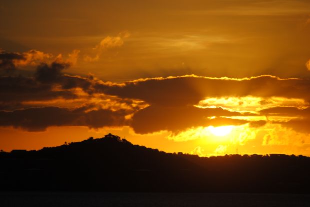
      Red skies at night...
      sailors delight. 
        
      One famous nautical superstition has sailors looking to the evening skies to determine the weather for the next day.   A colorful sunset with red skies meant the seas would be calm and the weather favorable delighting the sailors.

      What will the artist's canvas look like tonight as the final sunset is painted in the evening sky?    Let's hope that the sunset signals calm seas with favorable conditions for the coming year.

      Year of Disasters - Natural & Man Made

      Earthquakes, Tsunamis, Volcanoes, Hurricanes

      Photo courtesy Royal Caribbean International

      Early in 2010, a major earthquake hit Haiti killing or injuring  hundreds of thousands, causing billions of dollars of damage, and devastating this already struggling nation.

      The cruise industry and others rallied to try to help the country following the disaster.   Royal Caribbean, who has a long-standing relationship with the government of Haiti, led the cruise industry response (even while being criticized).  The nation would later suffer additional loss of life and damage when a hurricane struck the country.

      Later in the year, the world's eyes turned to the skies over Iceland as volcanic ash grounded flights over Europe disrupting travel across the entire world.   Passengers were stranded in airports for days until the ash cleared.

      Some passengers were unable to get to their cruise ships on time while in other cases, the ships provided an alternate means of travel for stranded air passengers.   It was a logistical nightmare for the entire travel industry and put additional strain on the economy.


      Hurricane season began with a vengeance and it was feared that the NOAA predictions of a higher than normal season would become a reality.   There were a larger than usual number of named storms and hurricanes, but fortunately, they didn't produce the devastation of years past. 

      That doesn't mean that there wasn't any loss of life or property damage.  As mentioned, Haiti did have substantial damage as did St. Lucia and other Caribbean countries.  Cruise itineraries were changed as storms approached or in their wake as services were restored.

      Oil Spill, Ship Fire

      During the height of hurricane season, an explosion on an oil rig caused loss of life and a major oil spill that would consume resources from the federal government and other agencies.  The spill severely endangered the ecology of the Gulf Coast region.    It took months to clean up and the effects of the spill will remain for many years to come.

      Cruises were not impacted during the spill as the impacted ports remained open. Despite the continued cruise line presence, the economic impact from the oil spill took its toll on the region.  Many people changed their vacation plans as the cleanup continued.

      The most recent major event of 2010 was the engine room fire on Carnival Splendor which stranded passengers on that cruise and impacted vacation plans through February next year.  The good news is that the industry will learn from this event and become even safer.

      Cruise Line Expansion

      2010 saw the introduction of several new cruise ships including Costa Deliziosa, MSC Magnifica, Celebrity Eclipse, P&O Azura, Norwegian Epic, Seabourn Sojourn, Holland America Nieuw Amsterdam, Cunard Queen Elizabeth, Royal Caribbean Allure of the Seas, and Disney Dream.

      The introduction of these new ships means there are more choices for the consumer.  As demand continues to increase, the capacity is keeping  pace assuring that a cruise vacation is well within the realm of possible vacation choices.

      While the economy and disasters have been front and center all year long,  passengers are returning to cruising and we anticipate prices will rise as 2011 pricing comes out.   There might be some time yet to take advantage of lower prices, so it is wise not to procrastinate.  

      Just like 2009, we saw an increase in first-time cruisers and those that have tried cruising continue to return year after year.    A cruise vacation remains an extremely good value making it a wise choice for those that decided to take a vacation.

      Let us close the book on this historic year together. Tomorrow, when you awake, open the book on what I hope will be a brighter tomorrow. Happy, Healthy, Prosperous New Year to all!!