Heavy Rainfall for Parts of Mexico
1130 AM EDT FRI SEP 6 2013
FOR THE NORTH ATLANTIC...CARIBBEAN SEA AND THE GULF OF MEXICO...
SPECIAL OUTLOOK ISSUED TO PROVIDE UPDATE
ON THE SYSTEM IN THE GULF
OF MEXICO.
GULF OF MEXICO
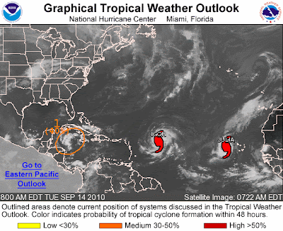
We have entered into the most active time of the 2013 Atlantic Hurricane Season and the image above reflects several potential storms that are being tracked today by the National Hurricane Center in Miami, Florida. The yellow color indicates that none of the storms have a high risk of developing into tropical cyclones in the next 48 hours, but that doesn't mean that there won't be associated weather (eg. heavy rains) in the area of the developing storms.
In particular, the low pressure area near Tampico Mexico is expected to move inland before becoming a tropical cyclone, but it is likely to bring 3 to 5 inches of rainfall and as much as 8 inches in the Mexican states of Veracruz and Tamaulipas during the next few days. Heavy winds, near tropical storm strength, are also expected which means that the area should be prepared to take appropriate actions just as they would if the tropical storm had already formed.
See: Tropical Depression Eight in Gulf of Mexico
REMNANTS of GABRIELLE
Unfavorable conditions are preventing the further development of the remnants from Tropical Storm Gabrielle, but that doesn't mean that development is completely out of the question. Once the storm moves further northwestward, over open Atlantic waters, it could redevelop as it heads towards Bermuda.
OTHER DEVELOPMENT
This time of year, storms near Cape Verde Islands are pretty common and often those storms are the ones that make landfall in the U.S. on the east coast. There is a low pressure system in the area, but there isn't an immediate risk of the storm becoming a tropical cyclone.
Click on the link above for the complete text of the Special Bulletin.


