Showing posts with label Isaac. Show all posts

Wednesday, August 29, 2012

Historical Cruise Impact of Isaac

Credit: NASA/SSAI, Hal Pierce
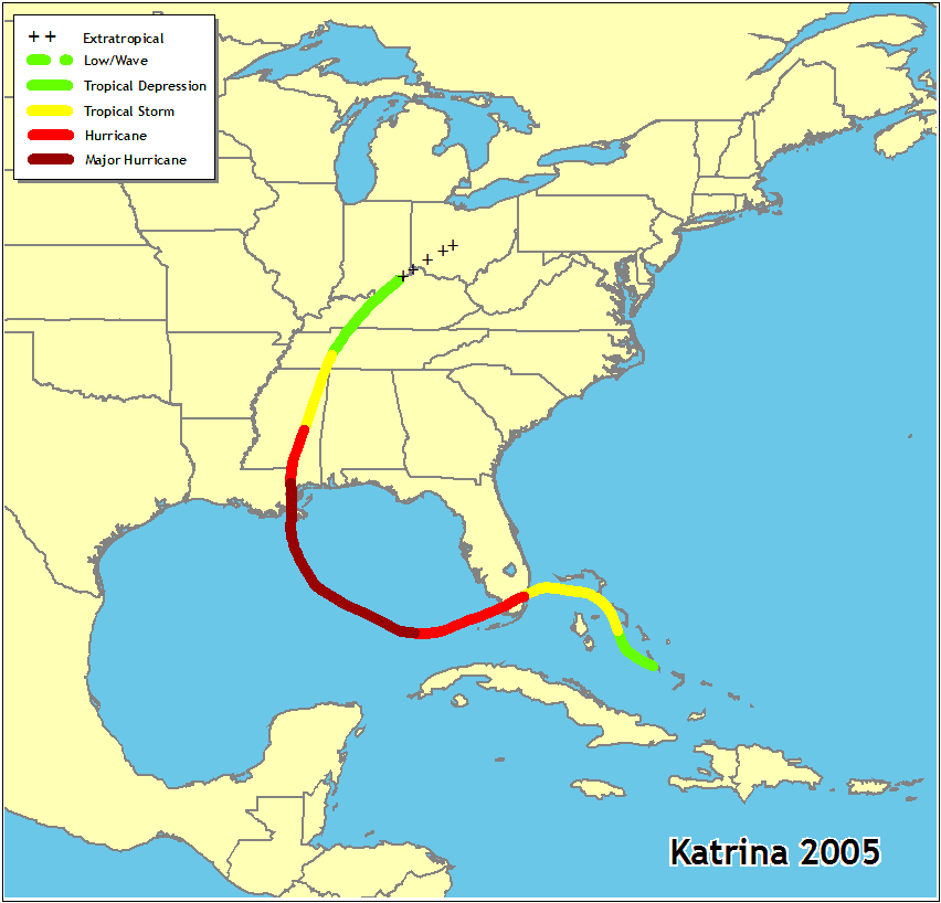
Hurricane Isaac
Impacted Several
Cruises
Current Impact:
In the interest of readability, we have split the historical cruise ship impact from the current advisories.  Select the article that covers the time period you are interested in.
 
Ongoing Coverage of Hurricane Isaac:

Tropical Storm Isaac in Atlantic

Historical Cruise Ship Impact
Carnival Cruise Line


8:45 PM EDT - UPDATE: CARNIVAL ELATION 08/31/12 - 3-DAY DEPARTURE:

FUNtastic news! The Port of New Orleans will reopen early tomorrow morning. 
Due to the time required to transit the Mississippi River, the ship will be alongside in the afternoon.  We’ll be busy saying good bye to our disembarking guests, so check in for your 3 day Fun Cruise @ Sea will now take place between 6:00 PM to 9:00 PM on Friday, August 31, 2012 at the Erato Street Cruise Terminal.  

So join us for three days of unforgettable fun and receive:
- 50% refund of your cruise fare (refunded within the next 2 weeks)
- 25% future cruise discount on a 3-5 day Carnival cruise (restrictions apply)
- Gratuities will be adjusted to reflect the shortened voyage
- Shore excursions purchased for Cozumel, as well as, the government fees and taxes, will be automatically refunded to your Sail & Sign account

Refunds will not be provided for flight changes, hotel accommodations, meals, transfers, or other incidental costs.  However, guests who purchased Carnival’s Vacation Protection Plan should check their plan for reimbursement considerations. 

Guests who purchased flights with Carnival's FlyAweigh program will automatically have their flights adjusted to the new day and time. You will be notified of your new flights by our Travel Services department. Guests with independent flight arrangements, please adjust your travel plans accordingly.
We certainly hope you’ll sail with us but if you elect to cancel, please contact 1-800-CARNIVAL to request your future cruise credit. 

To stay up to date, if you have not done so already, please sign up for text updates by texting CCL1 to CRUISE (278473).

Once again, we are sorry the weather has caused a delay in getting your fun started. Rest assured, once you step on board, we'll waste no time in getting it going!


TROPICAL STORM ISAAC UPDATE – 5:30 PM (EDT) August 29th
We are closely monitoring Tropical Storm Isaac and keeping in close contact with port officials.

CARNIVAL ELATION – 8/25/12 DEPARTURE
Officials at the Port of New Orleans have informed us the Mississippi River remains closed to ship traffic.  Since it is uncertain when the river will reopen, the Carnival Elation will now proceed to the Port of Mobile.  Weather permitting, debark will take place on Friday morning.  Guests will be bused back to New Orleans.

CARNIVAL ELATION 8/30 DEPARTURE

Our scheduled 4-day cruise will be shortened to a 3-day Fun Cruise @ Sea departing on Friday, August 31, 2012. Please proceed to the Port of New Orleans and plan to arrive between 1:00 PM and 4:00 PM on Friday. The parking garage at the port will be open.  Busses will take guests and their luggage to Mobile. 

We sincerely apologize for this disruption to your cruise.  Here are your options.
Sail with us and receive a:
- 50% refund of your cruise fare (refunded within the next 2 weeks)
- 25% future 3-5 day cruise discount (restrictions apply)
- Gratuities will be adjusted
- Refund of government fees and taxes
- Refunds will not be provided for flight changes, hotel accommodations, meals, transfers, or other incidental costs
Should you wish to cancel or reschedule, please contact 1-800-CARNIVAL to request your future cruise credit.
Guest who purchased flights with Carnival’s FlyAweigh program will automatically have their flights adjusted to the new day and time.  You will be notified of your new flights by our Travel Services department. Guests with independent flight arrangements, please adjust your travel plans accordingly.

To stay up to date on any changes, we encourage you to sign up for text alerts by texting CCL1 to CRUISE (278473). If you have already done so during your online check-in, you will automatically receive updates.

Once again, we’re very sorry that Mother Nature did not cooperate with our plans.  However, we’re confident you’ll have loads of fun on board.

At the moment, there are no changes expected for any other sailings departing on or after Thursday, August 30, 2012. In the event we need to make a deviation to a future itinerary, we will update our guests.
 

Due to its projected path, CARGO operations at the Port of New Orleans closed yesterday (Aug. 27) at 5 p.m and will remain closed today (Aug. 28) and tomorrow (Aug. 29). There's no word yet from Carnival Cruises Lines on whether the Aug. 30 departure of Carnival Elation, the next scheduled ship to sail out of New Orleans, will be affected.


CARNIVAL VALOR and CARNIVAL IMAGINATION – 8/27/12 DEPARTURE 
Good news! The Port of Miami has reopened. Check-in is set from 8:00pm to 11:00pm.  Due to limited seating, please do not proceed to the cruise terminal any earlier than 8:00 PM.  We’ve secured the Doubletree Convention Center in the event you need a place to wait. 711 N.W. 72nd Avenue, Miami, FL, 33126, Phn# 305-261-3800.  Also, enjoy dinner on us tonight. We will post a $25 per person credit to your Sail & Sign account.  


CARNIVAL DESTINY - 8/25/12 deprture
Carnival Destiny, departing on a five-night voyage from Miami on Saturday, will stop at Grand Cayman (instead of Ocho Rios) on Monday and Ocho Rios (instead of Grand Cayman) on Tuesday.

CARNIVAL DREAM - 8/25/12 departure
Carnival Dream, which will be departing on a seven-night sailing from Port Canaveral on Saturday, will skip its Nassau call on Sunday in favor of a sea day. The ship will now pay a visit to St. Maarten (instead of St. Thomas) on Tuesday and St. Thomas (instead of St. Maarten) on Wednesday, and a sea day originally scheduled for Thursday will be replaced with a call on Grand Turk.

CARNIVAL ECSTASY – 8/23/12 departure
Due to unfavorable weather conditions expected in Half Moon Cay tomorrow, the Carnival Ecstasy will cancel the call into Half Moon Cay and will replace it with a visit to Freeport on Saturday from 8:00 AM to 5:00 PM.  

CARNIVAL IMAGINATION – 8/24/12 DEPATURE 
The Port of Miami is expected to close by 11:00 PM on Saturday.  Weather permitting, the port will reopen on Monday at noon. The Carnival Imagination will remain at sea at a safe distance from the storm until the port reopens.
CARNIVAL IMAGINATION – 8/27/12 DEPATURE
Check-in for the Carnival Imagination is set for 4:00 PM – 7:30 PM and sailing is set for 8:00 PM.

CARNIVAL LEGEND – 8/19/12 DEPARTURE
The Port of Tampa is expected to close by 3:00 AM on Sunday. At this time, they are uncertain as to when the port will reopen. Therefore, we have made arrangements to dock at Port Canaveral instead, where we will arrive at 8:00 AM on Sunday. Busses will be available to take guests to the Port of Tampa or the Tampa airport. The parking garage at the port will be open.  It will take approximately two and a half hours to the Port of Tampa from Port Canaveral. 
CARNIVAL LEGEND – 8/26/12 DEPARTURE 
Due to the expected port closure in Tampa, the Carnival Legend will dock in Port Canaveral on Sunday.  We ask that guests proceed to the Port of Tampa and plan to arrive between 10:00 AM and 3:00 PM. The parking garage at the port will be open to park your vehicle. We will have busses available to take you and your luggage to Port Canaveral. Please do not proceed to Port Canaveral directly as the ship will be docking in Tampa when we return next week.  
It will take approximately two and a half hours to Port Canaveral from the Port of Tampa and no adverse weather is expected. The last bus will depart from Tampa at 4:00 PM and we expect to sail at 8:00 PM. 
At this time, our itinerary remains unchanged. However, there is a possibility we may have to make changes, depending on the path of the storm. 
CARNIVAL LIBERTY - 8/18/12 departure

Due to high winds and heavy swells, the Carnival Liberty cancelled the call into Grand Turk and replaced it with a visit to Nassau on Friday from 10:00 AM to 6:00PM.
CARNIVAL VALOR - 8/19/12 departure

In order to stay ahead of the storm and for the safety and comfort of our guests, the Carnival Valor cancelled the call into CuraƧao and replaced it with a visit to Nassau on Saturday from 10:00 AM to 5:00 PM. 


CARNIVAL VALOR – 8/26/12 DEPARTUREOur scheduled 6 day cruise will be shortened to a 5 day cruise visiting Grand Cayman and Montego Bay.  Unfortunately, this means we will cancel our call in Key West.  Check-in for your cruise is now scheduled on Monday August 27, 2012, from 4:00 PM to 7:30 PM, and sailing is set for 8:00 PM.  The times in Grand Cayman & Montego Bay remain unchanged.
We sincerely apologize for this disruption to your cruise.  Here are your options.
• Sail with us and receive a:
   - One-day pro-rated refund of your cruise fare (refunded within the next 2 weeks)
   - $50 per person on board credit
   - Refund of $13.11 for the government fees and taxes for Key West
   - Gratuities will also be adjusted to reflect the shortened voyage
   - Shore excursions purchased for Key West will be automatically refunded
   - Refunds will not be provided for flight changes, hotel accommodations, meals, transfers or other incidental costs.
• We realize this is an unexpected change in your travel plans and we certainly hope you still cruise with us.  However, should you wish to cancel or reschedule, please contact 1800 CARNIVAL to request your refund or future cruise credit.


CARNIVAL LEGEND – Text CCL2 to CRUISE (278473)
CARNIVAL VALOR – Text CCL 4 to CRUISE (278473)
CARNIVAL IMAGINATION – Text CCL5 to CRUISE (278473)

Disney Cruise Line

The safety of our Guests and Crew is always our first priority at Disney Cruise Line.
We are closely monitoring the current weather conditions and path of Tropical Storm Isaac through the National Weather Service.

At this time, we have not made any changes to the following itinerary:
  • Disney Dream August 29th, 4-night sailing to the Bahamas
Should weather conditions change, our Captains can alter the ship's course or itinerary for the safety and well being of our Guests.

Norwegian Cruise Line
Because of the storms, we are modifying the following itineraries:

Norwegian Sky will depart Miami today as scheduled on a three-day cruise to the Bahamas. The ship is cancelling its call to Great Stirrup Cay on Saturday. The ship will now call Nassau on Saturday from 8 am to 5 pm and spend Sunday at sea. Depending on the path of the storm, the ship may have a delayed arrival to Miami on Monday.

Norwegian Dawn will depart Boston as scheduled today to Bermuda. In order to maximize guests’ time ashore, the ship will arrive at 8 am on Sunday, three hours earlier than scheduled. Depending on the path of the storm, the ship may need to depart Bermuda earlier than scheduled.

Norwegian Gem will depart New York as scheduled on Saturday to the Bahamas & Florida. The ship will change the order of its ports, calling on Great Stirrup Cay on Tuesday, Nassau on Wednesday and Port Canaveral on Thursday.

Guests on board the vessels will be kept up to date by the ship’s Captain. It is also important to note that we will continue to closely monitor the storms and if the paths change, we may need to modify these itineraries.

We appreciate our guests’ understanding. As soon as there is further information, we will update NCL.com and notify our guests.

Royal Caribbean

ALLURE OF THE SEAS

Given Tropical Storm Isaac’s current location and projected path, and the forecasted weather for South Florida, Allure of the Seas’next sailing will now begin on Tuesday, August 28.  We ask that guests who are scheduled to sail on Allure of the Season Sunday, August 26, not arrive at the port until 11:30 a.m. on Tuesday, August 28.  We kindly ask that guests come to the terminal between 11:30 a.m. and 4:00 p.m. on Tuesday, August 28, for check-in and boarding. 

Regrettably, the delayed departure will have an impact on the scheduled itinerary.  Allure of the Seas will now spend Wednesday, August 29, at sea, call to Cozumel, Mexico, on Thursday, August 30, spend Friday, August 31, at sea, and Nassau, Bahamas, on Saturday, September 1.

If you are sailing on Allure of the Seas’next sailing and you feel you will not be able to arrive on Tuesday, please call us at 888-829-4050 in the U.S., and 408-926-9002 internationally.

MAJESTY OF THE SEAS

The Port of Miami closed at 11:00 p.m. yesterday evening and plans to reopen on Monday, August 27.  Because of this, Majesty of the Seas’boarding on Monday will be delayed.  Boarding will now start on Monday at 5:00 p.m.  Guests can begin arriving at 5:00 p.m. and should arrive no later than 8:00 p.m.

Majesty of the Seas will call on Nassau, Bahamas, on Tuesday, August 27, as scheduled.  However, the arrival time in Nassau may be impacted by the later departure.  More information will be provided to guests once they board the ship.

We encourage guests sailing Majesty of the Seas continue to monitor this website for any additional updates.

MONARCH OF THE SEAS

Boarding for Monarch of the Seas will begin at 1:00 p.m., as scheduled.  Monarch of the Seas will spend Wednesday, August 29, at sea, and call to CocoCay, Bahamas, on Thursday, August 30.

If you have not done so already, we strongly suggest guests complete their online check-in as soon as possible, including the section on your preferred method of contact while traveling.  You can access online check-in at www.royalcaribbean.com/onlinecheckin

Tuesday, August 28, 2012

Tale of Two Hurricanes Seven Years Apart

On this the eve of the seventh anniversary of Hurricane Katrina, Louisiana and the Gulf Coast were once again bracing for the impact of a hurricane.

Katrina was an extraordinarily powerful and deadly hurricane that first caused fatalities and damage in southern Florida as a Category 1 hurricane on the Saffir-Simpson Hurricane Scale. After reaching Category 5 intensity over the central Gulf of Mexico, Katrina weakened to Category 3 before making landfall on the northern Gulf coast.

Even so, the damage and loss of life inflicted by this massive hurricane in Louisiana and Mississippi were staggering, with significant effects extending into the Florida panhandle, Georgia, and Alabama. Considering the scope of its impacts, Katrina was one of the most devastating natural disasters in United States history.

New Orleans was severely impacted by Katrina, and has since rebuilt the levees that failed them back in 2005.   The burning question for town residents tonight was - would they hold with this latest approaching storm.

Fortunately, Hurricane Isaac was a much weaker storm, but don't let that fool you.  It had the potential to bring heavy rains, flooding, power outages, damaging winds, and all the hazards associated with tropical cyclones.

Isaac, which spans more than 200 miles, made landfall at about 6:45 p.m. local time near the mouth of the Mississippi River. New Orleans, about 75 miles to the northwest, was a ghost town as residents and tourists heeded warnings to stay indoors.   Except for low-lying areas which were under mandatory evacuation orders, the majority of the folks stayed here to ride out the storm.

Following is a comparison of the two storms.   We trace some of the significant milestones as the two storms headed from the Atlantic to the Caribbean Sea and into the Gulf of Mexico before making landfall.  For those that want even more information, see the storm and graphic archives on the NHC website.

For  Latest Impact (click here):  Tropical Storm Isaac in Atlantic


DATE / TIME KATRINA 2005 ISAAC 2012
Storm Archive
Storm Archive 
Storm Milestones, Watches & Warnings Issued
21 AUG
500 AM AST TUE AUG 21 2012
TD-9 forms east of Lesser Antilles, 
TS Warnings / Watches issued
1007 MB / 35 MPH
 
500 PM AST TUE AUG 21 2012
Strengthens to tropical storm 
1006 MB / 40 MPH 
 

1100 PM AST TUE AUG 21 2012
Puerto Rico, Virgin Islands 

22 AUG
500 AM AST WED AUG 22 2012
Dominican Republic
1003 MB / 45 MPH 
 
800 AM AST WED AUG 22 2012
British Virgin Islands 
1004 MB / 45 MPH  
 
200 PM AST WED AUG 22 2012
Leeward Islands
1006 MB / 45 MPH 

500 PM AST WED AUG 22 2012
Haiti
1004 MB / 45 MPH  
 
1100 PM AST WED AUG 22 2012
Eastern Caribbean
1003 MB / 45 MPH 

23 AUG
500 PM EDT TUE AUG 23 2005
TD 12 forms - Bahamas
TS Warnings issued
1007 MB / 35 MPH
 
1100 PM EDT TUE AUG 23 2005
Florida Keys, East coast
1007 MB / 35 MPH
 
 
1100 AM AST THU AUG 23 2012
South of Virgin Islands
1003 MB / 40 MPH 
 

500 PM AST THU AUG 23 2012
Bahamas, Cuba
1003 MB / 40 MPH 
 
1100 PM AST THU AUG 23 2012
Hispaniola
1001 MB / 45 MPH 
24 AUG
1100 AM EDT WED AUG 24 2005
Becomes tropical storm
Bahamas, Florida
1006 MB / 40 MPH  

500 PM EDT WED AUG 24 2005
SE Florida
1002 MB / 45 MPH  
 
1100 PM EDT WED AUG 24 2005  
Hurricane warnings
1001 MB / 50 MPH
800 AM EDT FRI AUG 24 2012
Jamaica
1000 MB / 50 MPH 
 
200 PM EDT FRI AUG 24 2012
Southern Hisapniola
997 MB / 50 MPH
 
1100 PM EDT FRI AUG 24 2012
Haiti Landfall
990 MB / 70 MPH
   
25 AUG
800 AM EDT THU AUG 25 2005
Better organized
999 MB / 50 MPH 

1100 AM EDT THU AUG 25 2005
Florida straits
997 MB / 60 MPH 
 
300 PM EDT THU AUG 25 2005 

Near hurricane strength
990 MB / 70 MPH 
500 PM EDT THU AUG 25 2005
Cat 1 Hurricane
985 MB / 75 MPH 
 
900 PM EDT THU AUG 25 2005 
Eye over NHC
984 MB / 80 MPH
 
1100 PM EDT THU AUG 25 2005
Eye over Miami-Dade
984 MB / 75 MPH
 
500 AM EDT SAT AUG 25 2012
South Florida, Keys
992 MB / 60 MPH
 
1100 AM EDT SAT AUG 25 2012
Florida East Coast
998 MB / 60 MPH
 
200 PM EDT SAT AUG 25 2012
East Coast Cuba
1000 MB / 60 MPH
  
1100 PM EDT SAT AUG 25 2012
Straits of Florida
997 MB / 60 MPH
 
26 AUG
100 AM EDT FRI AUG 26 2005
Weakens over land
980 MB / 70 MPH
 
700 AM EDT FRI AUG 26 2005
Westward over Gulf
987 MB / 75 MPH 
 
1100 AM EDT FRI AUG 26 2005
Stronger - West of Florida
981 MB / 80 MPH 
 
200 PM EDT FRI AUG 26 2005
Cat 2 Hurricane
969 MB / 100 MPH 
 
1100 PM EDT FRI AUG 26 2005
Expected to intensify
965 MB / 105 MPH
  
800 AM EDT SUN AUG 26 2012
Florida Keys
995 MB / 65 MPH
 
500 PM EDT SUN AUG 26 2012 
Key West
992 MB / 60 MPH
 
1100 PM EDT SUN AUG 26 2012
Eastern Gulf of Mexico
993 MB / 65 MPH 
  
27 AUG
200 AM EDT SAT AUG 27 2005
963 MB / 110 MPH
 
800 AM EDT SAT AUG 27 2005 
Cat 3 Hurricane
940 MB / 115 MPH
 
400 PM CDT SAT AUG 27 2005
Louisiana
945 MB / 115 MPH
 
1000 PM CDT SAT AUG 27 2005 
Threat North Central Gulf
939 MB / 115 MPH
  
500 AM EDT MON AUG 27 2012
Louisiana Coast
990 MB / 65 MPH 
 
1000 AM CDT MON AUG 27 2012 
Eastern Gulf of Mexico
988 MB / 65 MPH 
 
400 PM CDT MON AUG 27 2012
Storm surge threat
981 MB / 70 MPH
 
1000 PM CDT MON AUG 27 2012
Flooding threat
979 MB / 70 MPH
   
28 AUG
100 AM CDT SUN AUG 28 2005
Cat 4 Hurricane
New Orleans
935 MB / 145 MPH
 
700 AM CDT SUN AUG 28 2005
Cat 5 Hurricane
Northern Gulf Coast
908 MB / 165 MPH
 
100 PM CDT SUN AUG 28 2005
Still Cat 5
906 MB / 175 MPH 
 

1000 PM CDT SUN AUG 28 2005
Cat 5
904 MB / 160 MPH 
   
400 AM CDT TUE AUG 28 2012
Verge of becoming hurricane
977 MB / 70 MPH
 
1120 AM CDT TUE AUG 28 2012
Becomes Cat 1 Hurricane
975 MB / 75 MPH
 
700 PM CDT TUE AUG 28 2012
Landfall Extreme SE Louisiana
970 MB / 80 MPH 
 
1000 PM CDT TUE AUG 28 2012
Dangerous storm surge; flooding
968 MB / 80 MPH     
29 AUG
MIDNIGHT CDT MON AUG 29 2005
Nearing Louisiana coast
908 MB / 160 MPH 
 
600 AM CDT MON AUG 29 2005 
Cat 4 Near Shore
918 MB / 145 MPH
 
800 AM CDT MON AUG 29 2005
Pounding SE Louisiana
923 MB / 135 MPH 
 

1000 AM CDT MON AUG 29 2005
Weakens to Cat 3
Moving ashore near Louisiana
& Mississippi border
927 MB / 125 MPH 
 

NOON CDT MON AUG 29 2005
Weakens to Cat 2 over land
940 MB / 105 MPH 
 
400 PM CDT MON AUG 29 2005 
Weakens to Cat 1
960 MB / 75 MPH 
 

700 PM CDT MON AUG 29 2005
Now a tropical storm
965 MB / 65 MPH 
 
1000 PM CDT MON AUG 29 2005
Coastal warnings discontinued
973 MB / 60 MPH 
1200 AM CDT WED AUG 29 2012
Coast of Louisiana
969 MB / 80 MPH 

200 AM CDT WED AUG 29 2012
Nearly  stationary
968 MB / 80 MPH     
 
300 AM CDT WED AUG 29 2012
Second landfall 
969 MB / 80 MPH 
 
400 AM CDT WED AUG 29 2012 
Begins Moving Inland
969 MB / 80 MPH
 
600 AM CDT WED AUG 29 2012
Floods and heavy rains continue
970 MB / 80 MPH  
 
800 AM CDT WED AUG 29 2012 
970 MB / 80 MPH 

1200 PM CDT WED AUG 29 2012
SE Louisiana / Mississippi Rains
973 MB / 75 MPH 

200 PM CDT WED AUG 29 2012 
Weakens to Tropical Storm
974 MB / 70 MPH 

700 PM CDT WED AUG 29 2012
Slow moving - only 6 MPH
977 MB / 60 MPH 
 
1000 PM CDT WED AUG 29 2012
Only moved 60 miles all day
980 MB / 60 MPH 
 
30 AUG
400 AM CDT TUE AUG 30 2005
Weakens further
981MB / 50 MPH 
 
1000 AM CDT TUE AUG 30 2005
Still heavy rainfall
Weakens to tropical depression
985 MB / 35 MPH 
100 AM CDT THU AUG 30 2012
Heavy Rains & Severe Weather
Farther inland Louisiana
981 MB / 50 MPH 

400 AM CDT THU AUG 30 2012
983 MB / 45 MPH 
 
1000 AM CDT THU AUG 30 2012
987 MB / 40 MPH  

400 PM CDT THU AUG 30 2012
Weakens to Tropical Depression
995 MB / 35 MPH   
  
31 AUG  
No Advisories Issued
 
No Advisories Issued

Monday, August 27, 2012

Isaac Impacts Cruise Line Reservations

Cruise Line Offices
Operating With
Limited Staffing

Many businesses in southern Florida sent staff home early over the weekend and have been functioning with limited staffing since that time.

As the Port of Miami slowly resumes some operations today,  things may start to get back to normal.   

According to reports, there was flooding and downed trees due to Tropical Storm Isaac but the winds were less than expected as it still stays as tropical storm strength.

Oceania Cruises Statement

Tropical Storm Isaac Update Due to the tropical system affecting South Florida, we will be working with limited staffing Monday morning, and our hold times may be longer than normal. We expect to be fully staffed by noon EST, and thank you for your patience.

Saturday, August 25, 2012

Port Closures Due to Isaac


 Port of Mobile Closed


Carnival Elation (8/31 Departure) 

Hurricane Isaac - Itinerary Updates

Carnival Cruise Line is trying to get the next sailing of Carnival Elation, now a 3-day instead of a 4-day, to depart from Mobile, AL instead of New Orleans.  The Port of Mobile has not reopened yet nor has the Port of New Orleans, so for not, it's a waiting game.   If you are on that sailing, please sign up for text updates so that you'll have the correct embarkation information.

by texting CCL1 to CRUISE (278473)
 

Port of New OrleansUPDATED: SEPTEMBER 4th: Latest News: Power Restored, Napoleon Ave. Container Terminal Resumes Normal Operations


UPDATED AUGUST 28TH: Due to its projected path, CARGO operations at the port of New Orleans closed yesterday (Aug. 27) at 5 p.m and will remain closed today (Aug. 28) and tomorrow (Aug. 29).

There's no word yet from Carnival Cruises Lines on whether the Aug. 30 departure of Carnival Elation, the next scheduled ship to sail out of New Orleans, will be affected.

Cargo Operations To Cease Today, Port Ready For Isaac

Tampa, Miami, and Fort Lauderdale closed over the weekend, reopening yesterday. The closures caused some ships to remain at sea, sparking delays to their subsequent turn-around departures.

Port Miami 

Tropical Storm Isaac Disrupting Cruise Travel


For  Latest Impact (click here):  Tropical Storm Isaac in Atlantic


Miami-Dade County is currently monitoring Tropical Storm Isaac. For more information, visit the emergency website, monitor your local news or call 3-1-1 in Miami, FL.


CARNIVAL VALOR and CARNIVAL IMAGINATION – 8/27/12 DEPARTURE 
Good news! The Port of Miami has reopened. Check-in is set from 8:00pm to 11:00pm.  Due to limited seating, please do not proceed to the cruise terminal any earlier than 8:00 PM.  We’ve secured the Doubletree Convention Center in the event you need a place to wait. 711 N.W. 72nd Avenue, Miami, FL, 33126, Phn# 305-261-3800.  Also, enjoy dinner on us tonight. We will post a $25 per person credit to your Sail & Sign account.  

August 27, 2012 Updated
TROPICAL STORM ISAAC ALERT:
PortMiami is open. Cruise passengers are encouraged to contact their respective cruise lines for the latest itinerary information. Cargo users should contact the cargo yard for status of operations.

August 27, 2012
TROPICAL STORM ISAAC ALERT:
PortMiami is open for landside operations. Cargo users are encouraged to contact their respective cargo yard for their status of operations. Waterside operations remain closed.  The U.S. Coast Guard is scheduled to reassess the waterways at 2 p.m. Cruise passengers should contact the cruise lines for the latest itinerary information.

August 26, 2012
TROPICAL STORM ISAAC ALERT:
PortMiami is currently closed and will reopen on Monday, time to be determined. Cruise passengers are encouraged to contact their respective cruise line for more information regarding their itinerary.
August 25, 2012
TROPICAL STORM ISAAC ALERT:

PortMiami is OPEN and is scheduled to close tonight at 11 p.m. U.S. Coast Guard Captain of the Port has established Hurricane Port Readiness Condition Modified YANKEE. The Port is scheduled to open on Monday; time to be announced.

Miami-Dade Alerts
PhoneSubscribe now Online Service to the County's program to receive text alerts to cell phones or other mobile devices about significant emergency events.


The Tampa Port Authority, in conjunction with the Port Heavy Weather Advisory Group (PHWAG), is continuing to monitor T.S. Isaac, in determining the best and safest way to conduct port business, including all cargo and cruise operations.

Tampa Port AuthorityIn consideration of the possible threat of T.S. Isaac on the safe navigability of Tampa Bay, the port authority has been alerted by the U.S. Coast Guard--Sector St. Petersburg Captain of the Port that they have issued 'Condition X-ray' today at 9:00 a.m., and therefore no vessels will be allowed to move into or out of the Port of Tampa after 3:00 a.m. Sunday. There will be no exceptions, including cruise vessels, unless there is a significant change in storm path or intensity.


Wednesday, August 22, 2012

Tropical Storm Isaac in Atlantic

Tropical Storm Isaac Formed in Atlantic
Made Landfall as Cat 1 Hurricane

...TROPICAL DEPRESSION ISAAC BRINGING HEAVY RAINFALL AND THE THREAT OF FLASH FLOODING TO THE MIDDLE MISSISSIPPI RIVER VALLEY...

USEFUL LINKS FOR TROPICAL STORMS & HURRICANES (CLICK HERE) 

400 PM CDT THU AUG 30 2012
...SLOW-MOVING ISAAC WEAKENS TO A DEPRESSION OVER NORTHERN
LOUISIANA...
...FLOODING RAINS CONTINUE ACROSS SOUTHEASTERN LOUISIANA AND
MISSISSIPPI... 

 HPC issuing advisories on ISAAC
 
THIS IS THE LAST PUBLIC ADVISORY ISSUED BY THE NATIONAL HURRICANE
CENTER ON THIS SYSTEM. FUTURE INFORMATION ON THIS SYSTEM CAN BE
FOUND IN PUBLIC ADVISORIES ISSUED BY THE HYDROMETEOROLOGICAL
PREDICTION CENTER...UNDER AWIPS HEADER TCPAT4 AND WMO HEADER WTNT34
KWNH...BEGINNING AT 10 PM CDT.
 
On the 7th Anniversary of Hurricane Katrina, 
Louisiana has had another direct hit: 

Tale of Two Hurricanes Seven Years Apart 

The levee system played an important role during Isaac's visit to New Orleans - learn more about the project that restored the system after Katrina and also get real-time updates of the operations in progress to respond to Hurricane Isaac:


Rebuilding Hope - US Army Corps of Engineers New Orleans (PDF)

Update: August 30th

Tropical Storm Isaac continued to batter the Louisiana / Mississippi region today as it moved so slowly.  It has finally become a Tropical Depression and picked up some speed, up to 12 MPH.

Isaac is still impacting cruise schedules with Carnival Elation being the latest victim.  It was originally scheduled to sail out of New Orleans on a 4-day itinerary August 30th.   That was changed to a 3-day from Mobile, Alabama on August 31st.   Even that is at risk because both ports remain closed.   Carnival Cruise Line is monitoring the situation and advising passengers via text and posts on their website.   We have the link for updates below.
NHC issuing advisories on TS LESLIE, Hurricane KIRK and Hurricane ILEANA


Cruise Impact 

Cruise lines continue to monitor the progress of  Isaac which is expected to become a hurricane this weekend.   Several cruise itineraries have been impacted as well as ports have announced closures.

We will attempt to keep this site updated as additional changes are made to cruise ship itineraries. For the absolute latest published information see the cruise line links directly.

All changes are being made with the interest in safety of the ships, crew, and passengers.  Please be certain that you cruise specialist, cruise line, and airlines have your contact information.  Monitor the internet and other news media for updates.


New Orleans Airport Closed Thursday


In the interest of readability, we have split the historical cruise ship impact from the current advisories.  Click the following link for information about cruises that were impacted earlier.
 

Carnival Cruise Line


8:45 PM EDT - UPDATE: CARNIVAL ELATION 08/31/12 - 3-DAY DEPARTURE:
FUNtastic news! The Port of New Orleans will reopen early tomorrow morning. 
Due to the time required to transit the Mississippi River, the ship will be alongside in the afternoon.  We’ll be busy saying good bye to our disembarking guests, so check in for your 3 day Fun Cruise @ Sea will now take place between 6:00 PM to 9:00 PM on Friday, August 31, 2012 at the Erato Street Cruise Terminal.

So join us for three days of unforgettable fun and receive:
- 50% refund of your cruise fare (refunded within the next 2 weeks)
- 25% future cruise discount on a 3-5 day Carnival cruise (restrictions apply)
- Gratuities will be adjusted to reflect the shortened voyage
- Shore excursions purchased for Cozumel, as well as, the government fees and taxes, will be automatically refunded to your Sail & Sign account

Refunds will not be provided for flight changes, hotel accommodations, meals, transfers, or other incidental costs.  However, guests who purchased Carnival’s Vacation Protection Plan should check their plan for reimbursement considerations.

Guests who purchased flights with Carnival's FlyAweigh program will automatically have their flights adjusted to the new day and time. You will be notified of your new flights by our Travel Services department. Guests with independent flight arrangements, please adjust your travel plans accordingly.
We certainly hope you’ll sail with us but if you elect to cancel, please contact 1-800-CARNIVAL to request your future cruise credit.

To stay up to date, if you have not done so already, please sign up for text updates by texting CCL1 to CRUISE (278473).

Once again, we are sorry the weather has caused a delay in getting your fun started. Rest assured, once you step on board, we'll waste no time in getting it going!

----------------------  End of Cruise Ship Impact Section -------------------------


SUMMARY OF 400 PM CDT...2100 UTC...INFORMATION
----------------------------------------------
LOCATION...32.7N 92.6W
ABOUT 35 MI...55 KM WNW OF MONROE LOUISIANA
ABOUT 40 MI...60 KM SSE OF EL DORADO ARKANSAS
MAXIMUM SUSTAINED WINDS...35 MPH...55 KM/H
PRESENT MOVEMENT...NNW OR 335 DEGREES AT 12 MPH...19 KM/H
MINIMUM CENTRAL PRESSURE...995 MB...29.38 INCHES


WATCHES AND WARNINGS
--------------------

CHANGES WITH THIS ADVISORY...

ALL COASTAL WARNINGS HAVE BEEN DISCONTINUED.

SUMMARY OF WATCHES AND WARNINGS IN EFFECT...

THERE ARE NO COASTAL WATCHES OR WARNINGS IN EFFECT


A HURRICANE WARNING MEANS THAT HURRICANE CONDITIONS ARE EXPECTED
SOMEWHERE WITHIN THE WARNING AREA. A WARNING IS TYPICALLY ISSUED
36 HOURS BEFORE THE ANTICIPATED FIRST OCCURRENCE OF TROPICAL STORM
FORCE WINDS...CONDITIONS THAT MAKE OUTSIDE PREPARATIONS DIFFICULT
OR DANGEROUS. PREPARATIONS TO PROTECT LIFE AND PROPERTY SHOULD BE
RUSHED TO COMPLETION.

A HURRICANE WATCH MEANS THAT HURRICANE CONDITIONS ARE POSSIBLE
WITHIN THE WATCH AREA...IN THIS CASE WITHIN THE NEXT 24 TO 36 HOURS. 
 
A TROPICAL STORM WARNING MEANS THAT TROPICAL STORM CONDITIONS ARE
EXPECTED SOMEWHERE WITHIN THE WARNING AREA WITHIN 36 HOURS.

A TROPICAL STORM WATCH MEANS THAT TROPICAL STORM CONDITIONS ARE
POSSIBLE WITHIN THE WATCH AREA...GENERALLY WITHIN 48 HOURS.

MAXIMUM SUSTAINED WINDS ARE NEAR 35 MPH...55 KM/H...WITH HIGHER
GUSTS.  GRADUAL WEAKENING IS FORECAST DURING THE NEXT 48 HOURS...AND
ISAAC IS EXPECTED TO BECOME A POST-TROPICAL REMNANT LOW PRESSURE
SYSTEM BY SATURDAY.

HAZARDS AFFECTING LAND
----------------------
EVEN THOUGH ISAAC IS NO LONGER A TROPICAL STORM...DANGEROUS
HAZARDS FROM STORM SURGE...INLAND FLOODING...AND TORNADOES ARE
STILL OCCURRING.

STORM SURGE...WATER LEVELS WILL REMAIN ELEVATED IN SOUTHEASTERN
LOUISIANA AND COASTAL MISSISSIPPI THROUGH TONIGHT...AND GRADUALLY
SUBSIDE TOMORROW. FOR INFORMATION SPECIFIC TO YOUR AREA...PLEASE
SEE PRODUCTS ISSUED BY YOUR LOCAL WEATHER SERVICE OFFICE.  

BASED ON OBSERVATIONS FROM NATIONAL OCEAN SERVICE TIDE GAGES...AT
NEW CANAL STATION LOUISIANA...A STORM SURGE OF MORE THAN 5 FEET IS
PERSISTING ALONG THE SOUTHERN SHORE OF LAKE PONTCHARTRAIN...AND A
STORM SURGE VALUE OF NEAR 4 FEET CONTINUES AT WAVELAND MISSISSIPPI.

WIND...TROPICAL-STORM-FORCE WIND GUSTS COULD OCCUR ALONG THE COASTS
OF SOUTHEASTERN LOUISIANA AND MISSISSIPPI THROUGH THIS AFTERNOON.

RAINFALL...ISAAC IS EXPECTED TO PRODUCE TOTAL RAINFALL ACCUMULATIONS
OF 7 TO 14 INCHES...WITH POSSIBLE ISOLATED MAXIMUM AMOUNTS OF 25
INCHES...OVER NORTHERN AND EASTERN LOUISIANA....MUCH OF MISSISSIPPI
AND SOUTHWEST ALABAMA.  RAINFALL TOTALS OF 3 TO 6 INCHES WITH
ISOLATED MAXIMUM AMOUNTS OF 8 INCHES POSSIBLE ACROSS ARKANSAS AND
INTO SOUTHERN MISSOURI THROUGH FRIDAY.  THESE RAINS COULD RESULT IN
SIGNIFICANT LOWLAND FLOODING.  THE HEAVY RAIN POTENTIAL WILL BE
SPREADING EASTWARD THIS WEEKEND INTO PORTIONS OF THE MID WEST AND
OHIO VALLEY REGION. 

TORNADOES...TORNADOES ARE POSSIBLE ALONG THE CENTRAL GULF COAST
REGION AND PARTS OF THE LOWER MISSISSIPPI RIVER VALLEY THROUGH
TONIGHT.

SURF...DANGEROUS SURF AND RIP CURRENT CONDITIONS WILL CONTINUE TO
AFFECT THE WEST COAST OF FLORIDA AND THE NORTHERN GULF COAST THROUGH
TONIGHT BEFORE SUBSIDING ON SATURDAY.

Historical Data:     Archive       Graphics Archive

500 AM AST TUE AUG 21 2012
 
...NINTH DEPRESSION OF THE SEASON FORMS EAST OF THE LESSER
ANTILLES...TROPICAL STORM WARNINGS AND WATCHES ISSUED...
 
800 PM AST TUE AUG 21 2012
 
...ISAAC CONTINUES MOVING TOWARD THE LESSER ANTILLES...
 
800 AM AST WED AUG 22 2012
 
...ISAAC NEARING THE LESSER ANTILLES...HURRICANE WATCH ISSUED FOR
THE BRITISH VIRGIN ISLANDS... 
 
800 PM AST WED AUG 22 2012
 
...ISAAC ENTERS THE EASTERN CARIBBEAN...
 
200 PM AST THU AUG 23 2012
 
...CENTER OF ISAAC NOW MOVING WEST-NORTHWESTWARD SOUTH OF PUERTO
RICO... 
 
630 AM EDT FRI AUG 24 2012
 
AT 630 AM EDT...1030 UTC...THE GOVERNMENT OF JAMAICA HAS ISSUED A
TROPICAL STORM WATCH FOR JAMAICA. 
 
200 PM EDT FRI AUG 24 2012
 
...ISAAC TURNS NORTHWESTWARD...CENTER APPROACHING THE SOUTHERN COAST
OF HISPANIOLA...
 
200 AM EDT SAT AUG 25 2012
 
...CENTER OF ISAAC NEAR THE SOUTH COAST OF HAITI...
 
500 AM EDT SAT AUG 25 2012
 
...ISAAC EMERGING FROM THE COAST OF HAITI...NEW WATCHES AND WARNINGS
ISSUED FOR SOUTH FLORIDA AND THE KEYS...  
 
1100 AM EDT SAT AUG 25 2012
 
...CENTER OF ISAAC NEAR EASTERN CUBA...NEW WATCHES AND WARNINGS FOR
PORTIONS OF FLORIDA...
 
200 PM EDT SAT AUG 25 2012
 
...CENTER OF ISAAC NOW NEAR THE NORTH COAST OF EASTERN CUBA...
 
Tropical Storm Isaac made landfall along the southern coast of Haiti early Saturday morning, and has begun to move away from Haiti and towards southeastern Cuba, with its circulation relatively intact.
Isaac is expected to make landfall in southeastern Cuba this afternoon, then skirt the northeastern coast of Cuba through the overnight hours tonight.

Once off the northern coast of Cuba, Isaac is expected to strengthen into a hurricane over the warmer waters of the Florida Straits and cross the Florida Keys sometime Sunday night or early Monday morning, then head into the very warm waters of the eastern Gulf of Mexico.


1100 PM EDT SUN AUG 26 2012
 
...ISAAC FORECAST TO STRENGTHEN AS IT MOVES OVER THE EASTERN 
GULF OF MEXICO...
 
1000 AM CDT MON AUG 27 2012
 
...ISAAC MOVING WEST-NORTHWESTWARD OVER THE EASTERN GULF OF
MEXICO...POSES SIGNIFICANT STORM SURGE THREAT TO THE NORTHERN GULF
COAST...
 
Hurricane warnings have been issued for portions of the northern Gulf Coast as  Tropical Storm Isaac continues its west-northwestward march into the Gulf of Mexico. 

Isaac will continue to affect southern Florida with heavy rain, gusty winds and a tornado threat as it moves through the Florida Keys and into the Gulf Sunday evening. Isaac poses a potential serious threat to portions of the northern Gulf Coast Tuesday into Wednesday. All interests from Louisiana to Mississippi, Alabama and the Florida Panhandle should watch the progress of Isaac closely and begin to make preparations. Even areas as far west as extreme southeast Texas should continue to monitor Isaac's progress in case a farther west track materializes.
 

1120 AM CDT TUE AUG 28 2012

...RECONNAISSANCE DATA INDICATE ISAAC FINALLY ACHIEVES HURRICANE
STATUS...


(UPDATE: August 28th)

Hurricane Isaac is impacting travelers and the transportation industry causing hundreds of flight cancellations and delays.
Isaac's peak impacts are bearing down on the Gulf Coast beginning today. Hurricane warnings continue for portions of the northern Gulf Coast, including New Orleans, Biloxi and Gulf Shores as Isaac continues its northwestward march. Hurricane watches are posted as far west as Morgan City, La. 

In addition, a number of tropical storm warnings are in effect. A tropical storm warning is in effect for the Florida Panhandle. 

Even as Isaac's center of circulation moves by, locally heavy rainbands can be expected. Rainfall amounts over 10" are likely as Isaac slows down immediately prior to, and after landfall, in southeast Louisiana, southern Alabama, Mississippi and the western Florida Panhandle. In a few cases, amounts exceeding 20" are possible.   We have already seen in excess of 9" of rain in some parts of the Florida east coast.

Expect business closures and air, maritime, and ground transport disruptions throughout the region. Prolonged power and telecommunications outages are also possible.
                     
700 PM CDT TUE AUG 28 2012
 
...ISAAC MAKES LANDFALL IN EXTREME SOUTHEASTERN LOUISIANA...
...STRONG WINDS AND A DANGEROUS STORM SURGE OCCURRING ALONG THE
NORTHERN GULF COAST... 
 
800 PM CDT TUE AUG 28 2012
 
...ISAAC MOVING SLOWLY NORTHWESTWARD ALONG THE COAST OF SOUTHEAST
LOUISIANA...DANGEROUS STORM SURGE CONTINUING ALONG THE NORTHERN
GULF COAST...
 
1000 PM CDT TUE AUG 28 2012
 
...ISAAC PRODUCING A DANGEROUS STORM SURGE ALONG THE NORTHERN
GULF COAST...FLOODING FROM RAINFALL TO FOLLOW... 
 
 
(Update: August 29)

Hurricane Isaac made landfall in Southeast Louisiana at 6:45 PM local time on Tuesday.  It made a second landfall overnight around 3 AM.   This slow moving storm is dumping rain on the entire area, knocking out power to half a million people as 80 MPH winds continue to pound Louisiana.

Damage is expected to be much higher than normal for this category hurricane, it is still a Category One, because of the slow movement.   In addition to the storm surge, heavy rains, and flooding, there is a potential for tornadoes to be spawned from the storm.

200 AM CDT WED AUG 29 2012
 
...ISAAC REMAINS NEARLY STATIONARY NEAR THE COAST OF SOUTHEAST
LOUISIANA...DANGEROUS STORM SURGE AND FLOOD THREAT FROM HEAVY RAINS
CONTINUES...
 
300 AM CDT WED AUG 29 2012 
...CENTER OF ISAAC MAKES SECOND LANDFALL... 
 
400 AM CDT WED AUG 29 2012
 
...ISAAC BEGINNING TO MOVE INLAND IN SOUTHEAST LOUISIANA...DANGEROUS
STORM SURGE AND FLOOD THREAT FROM HEAVY RAINS LIKELY TO CONTINUE
THROUGH TODAY AND TONIGHT...
 
800 AM CDT WED AUG 29 2012
 
...ISAAC LASHING SOUTHEASTERN LOUISIANA WITH STRONG SQUALLS...
DANGEROUS STORM SURGE AND FLOOD THREAT FROM HEAVY RAINS LIKELY TO
CONTINUE THROUGH TODAY AND TONIGHT...
 
200 PM CDT WED AUG 29 2012
 
...ISAAC WEAKENS TO A TROPICAL STORM...LIFE-THREATENING HAZARDS FROM
STORM SURGE AND INLAND FLOODING ARE STILL OCCURRING...
 
 
1000 PM CDT WED AUG 29 2012

...HEAVY RAIN THREAT FROM ISAAC TO SPREAD INLAND DURING THE
NEXT FEW DAYS...WATER LEVELS REMAIN HIGH ALONG THE NORTHERN
GULF COAST...

Update: August 30th

Tropical Storm Isaac continued to batter the Louisiana / Mississippi region today as it moved so slowly.  It has finally become a Tropical Depression and picked up some speed, up to 12 MPH.